Image Credit: NASA/USGS Landsat; Geoscience Australia
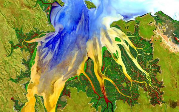
This image, captured by the Landsat 8 satellite, shows the view over Western Australia on May 12, 2013. The image shows rich sediment and nutrient patterns in a tropical estuary area and complex patterns and conditions in vegetated areas.
The image is enhanced and involved masking, separately enhancing and then reassembling water and land portions of the image. The water patterns are the result of an RGB display of Landsat-8’s red, blue, and ultra-blue bands. Land is shown using short-wavelength-infrared, near-infrared and green.
這張由 Landsat 8 衛星拍攝的影象顯示了 2013 年 5 月 12 日澳大利亞西部的景色。該影象顯示了熱帶河口地區豐富的沉積物和養分模式以及植被區的複雜模式和條件。
影象被增強並涉及掩蔽,分別增強然後重新組合影象的水和陸地部分。 水紋是 Landsat-8 的紅色、藍色和超藍色波段 RGB 顯示的結果。 土地使用短波長紅外、近紅外和綠色顯示。


